Explain Lava Field
Lava Field Technical Terms
Lava Field: An area covered primarily by lava flows whose terrain can be rough and broken or relatively smooth; it can include vent structures (e.g., small cinder cones, spatter cones, etc.), surface flow structures (e.g., pressure ridges, tumuli, etc.) and small, intermittent areas covered with pyroclastics. Compare – lava plain, volcanic field. SW
Expose Lava Flow

Lava Flow Technical Terms
Lava Flow: A solidified body of rock formed from the lateral, surficial outpouring of molten lava from a vent or fissure, often lobate in form. Compare - `a`a lava flow, lava flow unit, pahoehoe lava flow. GG
Discover Lava Plain

Lava Plain Technical Terms
Lava Plain: A broad area of nearly level land, that can be localized but is commonly hundreds of square kilometers in extent, covered by a relatively thin succession of primarily basaltic lava flows resulting from fissure eruptions. Compare – lava plateau, lava field, volcanic field. SW & GG
Explain Lava Flow Unit
Lava Flow Unit Technical Terms
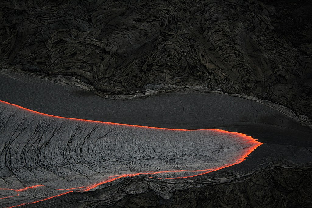
Lava Flow Unit: A separate, distinct lobe of lava that issues from the main body of a lava flow; a specific outpouring of lava, a few centimeters to several meters thick and of variable lateral extent that forms a subdivision within a single flow. A series of overlapping lava flow-units together comprise a single lava flow. Also called flow unit. Compare – lava flow. GS & GG
Explain Lava Plateau

Lava Plateau Technical Terms
Lava Plateau: A broad elevated tableland or flat-topped highland that may be localized but commonly is many hundreds or thousands of square kilometers in extent, underlain by a thick succession of basaltic lava flows resulting from fissure eruptions (e.g. Columbia River Plateau). Compare – lava plain, lava field. GG
Expose Lava Trench
Lava Trench Technical Terms
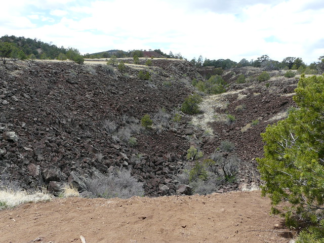
Lava Trench: A natural surface channel in a lava flow that never had a roof, formed by the surficial draining of molten lava rather than by erosion from running water; also called lava channel. Compare – mawae, lava tube. SW
Remember Lava Tube

Lava Tube Technical Terms
Lava Tube: A natural, hollow tunnel beneath the surface of a solidified lava flow through which the lava flow was fed; the tunnel was left empty when the molten lava drained out. MA & GG
Explain Ledge

Ledge Technical Terms
Ledge: A narrow shelf or projection of rock, much longer than wide, formed on a rock wall or cliff face, as along a coast by differential wave action on softer rocks; erosion is by combined biological and chemical weathering. (b) A rocky outcrop; solid rock. (c) A shelf-like quarry exposure or natural rock outcrop. Compare - structural bench. GG
Discover Lee

Lee Technical Terms
Lee: Said of a side or slope that faces away from an advancing glacier or ice sheet, and facing the downstream (“down-ice”) side of a glacier and relatively protected from its abrasive action. Compare – stoss, stoss and lee, crag and tail. GG
Expose Levee

Levee Technical Terms
Levee: An artificial or natural embankment built along the margin of a watercourse or an arm of the sea, to protect land from inundation or to confine streamflow to its channel. Compare artificial levee, natural levee. GG
Discover Leveled Land
Leveled Land Technical Terms
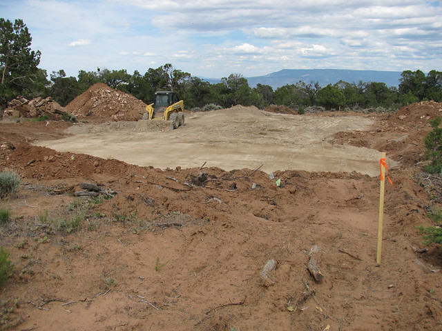
Leveled Land: A land area, usually a field, that has been mechanically flattened or smoothed to facilitate management practices such as flood irrigation; as a result the natural soil has been partially or completely modified (e.g., truncated or buried). SW
Expose Limestone

Limestone Technical Terms
Limestone: A sedimentary rock consisting chiefly (more than 50 percent) of calcium carbonate, primarily in the form of calcite. Limestones are usually formed by a combination of organic and inorganic processes and include chemical and clastic (soluble and insoluble) constituents; many contain fossils. HP
Discover Linear Gilgai

Linear Gilgai Technical Terms
Linear Gilgai: A type of gilgai dominated by parallel micro-low troughs separated by low ridges (micro-highs) and oriented perpendicular to the topographic contour (i.e., up and down slopes); the prevailing type of gilgai on sloping terrain (slopes > 8 %). Compare – circular gilgai, elliptical gilgai, gilgai. SW
Discover Lithification
Lithification Technical Terms
Lithification: The conversion of unconsolidated sediment into a coherent and solid rock, involving processes such as cementation, compaction, desiccation, crystallization, recrystallization, and compression. It may occur concurrently with, shortly after, or long after deposition. HP
Discover Local Relief

Local Relief Technical Terms
Local Relief: A general term referring to the prevailing difference in elevation between the lowest and highest parts of the landscape at a given locale (e.g. the average difference in elevation between a representative portion of a valley floor and the tops of the bounding valley walls). SW
Remember Lodgment Till
Lodgment Till Technical Terms
Lodgment Till: A basal till commonly characterized by compact, fissile ("platy") structure and containing coarse fragments oriented with their long axes generally parallel to the direction of ice movement. Compare - till, flow-till, melt-out till. GG
Explain Loess

Loess Technical Terms
Loess: Material transported and deposited by wind and consisting predominantly of silt-size particles. Commonly a loess deposit thins and the mean-particle size decreases as distance from the source area increases. Loess sources are dominantly from either glacial meltwaters (i.e. “cold loess”) or from non-glacial, arid environments, such as deserts (i.e. ”hot loess”). [soil survey] Several types of loess deposits can be recognized based on mineralogical composition (calcareous loess, non-calcareous loess). SW & GSST
Explain Loess Bluff

Loess Bluff Technical Terms
Loess Bluff: A bluff composed of a thick deposit of coarse loess, formed immediately adjacent to the edges of flood plains, as along the Mississippi River valley or China. Sometimes referred to as a bluff formation (not preferred). SW & GG.
Explain Loess Hill

Loess Hill Technical Terms
Loess Hill: A hill composed of thick deposits of loess, as in IA, MO, NE and the Palouse Hills of WA & ID. SW
Discover Log Landing

Log Landing Technical Terms
Log Landing: A comparatively level area, usually with road access, constructed or cut into steeper slopes and used for sorting logs during timber harvest operations. Compare – skid trail. SW
Remember Longitudinal Dune

Longitudinal Dune Technical Terms
Longitudinal Dune: A long, narrow sand dune, usually symmetrical in cross profile, oriented parallel to the prevailing wind direction ; it is wider and steeper on the windward side but tapers to a point on the lee side. It commonly forms behind an obstacle in an area where sand is abundant and the wind is strong and constant. Such dunes can be a few meters high and up to 100 km long. Compare – seif dune, transverse dune. GG
Expose Louderback

Louderback Technical Terms
Louderback: A hill or ridge composed of a lava flow remnant that caps or is exposed in a tilted fault block and bounded by a dip slope. Used as evidence of block faulting in Basin-and-Range terrain (western USA). Compare – hogback. GG
Remember Low-Center Polygon

Low-Center Polygon Technical Terms
Low-Center Polygon: A polygon whose center is depressed relative to its boundary. Compare - high-center polygon. NRC
Discover Low Hill

Low Hill Technical Terms
Low Hill: A generic name for an elevated, generally rounded land surface with low local relief, rising between 30 meters (100 ft.) to as much as 90 m (approx. 300 ft.) above surrounding lowlands. Compare – high hill, hill, hillock. SW
Expose Lowland

Lowland Technical Terms
Lowland: An informal, generic, imprecise term for low-lying land or an extensive region of low-lying land, especially near a coast and including the extended plains or country lying not far above tide level. (b) (not preferred) A generic, imprecise term for a landscape of low, comparatively level ground of a region or local area, in contrast with the adjacent higher country. (c) (not recommended – use valley, bolson, etc.) A generic term for a large valley. Compare - upland. SW
Remember Low Marsh
Low Marsh Technical Terms
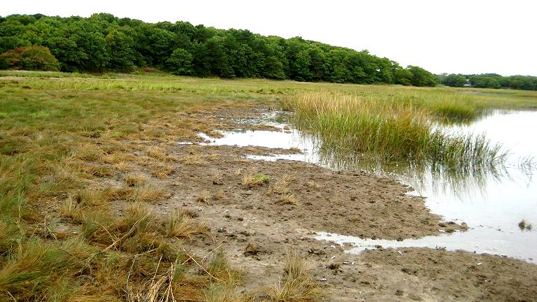
Low Marsh: (refer to mud flat). The flat, usually bare ground situated seaward of a salt marsh and regularly covered and uncovered by the tide; e.g., a mud flat. GG
Expose Mafic Rock

Mafic Rock Technical Terms
Mafic Rock: A general term for igneous rock composed chiefly of one or more ferromagnesian, dark-colored minerals; also said of those minerals. Compare - felsic rock. GG
Discover Mainland Cove

Mainland Cove Technical Terms
Mainland Cove: A subaqueous area adjacent to the mainland or a submerged mainland beach that forms a minor recess or embayment within the larger basin. Compare – cove, barrier cove. SSS
Expose Maar
Maar Technical Terms
Maar: A low relief, broad volcanic crater formed by multiple, shallow explosive eruptions. It is surrounded by a crater ring in the form of low ramparts of gently dipping (i.e. < 25 degrees), well-bedded ejecta; may be partially or completely filled by water (maar lake). SW & GG
Discover Lowmoor Bog

Lowmoor Bog Technical Terms
Lowmoor Bog: A bog that is at or only slightly above the water table, on which it depends for accumulation and preservation of peat (chiefly the remains of sedges, reeds, shrubs, and various mosses). Compare - highmoor bog, raised bog. GG
Expose Lateral Spread

Lateral Spread Technical Terms
Lateral Spread: A category of mass movement processes, associated sediments (lateral spread deposit) or resultant landforms characterized by a very rapid spread dominated by lateral movement in a soil or fractured rock mass resulting from liquefaction or plastic flow of underlying materials; also called spread. Types of lateral spreads can be specified based on the dominant particle size of sediments (i.e. debris spread, earth spread, rock spread. Compare – fall, topple, slide, flow, complex landslide, landslide. SW, DV & GG
Explain Lapilli
Lapilli Technical Terms
Lapilli: Non or slightly vesicular pyroclastics, 2.0 to 76 mm in at least one dimension, with an apparent specific gravity of 2.0 or more. Compare - ash [volcanic], block [volcanic], cinders, tephra. KST
Discover Land-Surface Form

Land-Surface Form Technical Terms
Land-Surface Form: The description of a given terrain unit based on empirical analysis of the land surface rather than interpretation of genetic factors. Surface form may be expressed quantitatively in terms of vertical and planimetric slope-class distribution, local and absolute relief, and patterns of terrain features such as interfluve crests, drainage lines, or escarpments. HP
Discover Landslide

Landslide Technical Terms
Landslide: A general, encompassing term for most types of mass movement landforms and processes involving the downslope transport and outward deposition of soil and rock materials, caused by gravitational forces and which may or may not involve saturated materials. Names of landslide types generally reflect the dominant process and/or the resultant landform. The main operational categories of mass movement are fall (rockfall, debris fall, soil fall), topple (rock topple, debris topple, soil topple), slide (rotational landslide, block glide, debris slide, lateral spread), flow [rock fragment flow (especially rockfall avalanche), debris avalanche, debris flow (e.g., lahar), earthflow, (creep, mudflow)], and complex landslides. Compare – solifluction. SW & DV
Remember Landscape

Landscape Technical Terms
Landscape: A broad or unique land area comprised of an assemblage or collection of landforms that define a general geomorphic form or setting (e.g., mountain range, lake plain, lava plateau, or loess hill) Landforms within a landscape are spatially associated, but may vary in formation processes and age. SW & GSST
Explain Landform

Landform Technical Terms
Landform: Any physical, recognizable form or feature on the earth's surface, having a characteristic shape, internal composition, and produced by natural causes; a distinct individual produced by a set of processes. Landforms can span a large size (e.g., dune encompasses a number of feature including parabolic dune, which is tens-of-meters across and seif dune, which can be up to a 100 kilometers across. Landforms provide an empirical description of the earth's surface features. SW & GG
Explain Lamina

Lamina Technical Terms
Lamina: (noun) The thinnest recognizable layer (commonly < 1 cm thick) of original deposition in a sediment or sedimentary rock, differing from other layers in color, composition, or particle size. Several laminae constitute a bed. Compare - lamella. GG
Explain Lake Terrace

Lake Terrace Technical Terms
Lake Terrace: A narrow shelf, partly cut and partly built, produced along a lake shore in front of a scarp line of low cliffs and later exposed when the water level falls. GG
Remember Intrusive
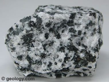
Intrusive Technical Terms
Intrusive: Denoting igneous rocks derived from molten matter (magmas) that invaded pre-existing rocks and cooled below the surface of the earth. Compare - extrusive. HP
Remember Lakeshore
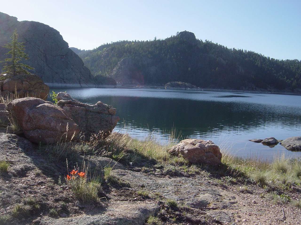
Lakeshore Technical Terms
Lakeshore: The narrow strip of land in contact with or bordering a lake; especially the beach of a lake. GG
Explain Lake Plain

Lake Plain Technical Terms
Lake Plain: A nearly level surface marking the floor of an extinct lake filled by well-sorted, generally fine-textured, stratified deposits, commonly containing varves. GG
Remember Lake
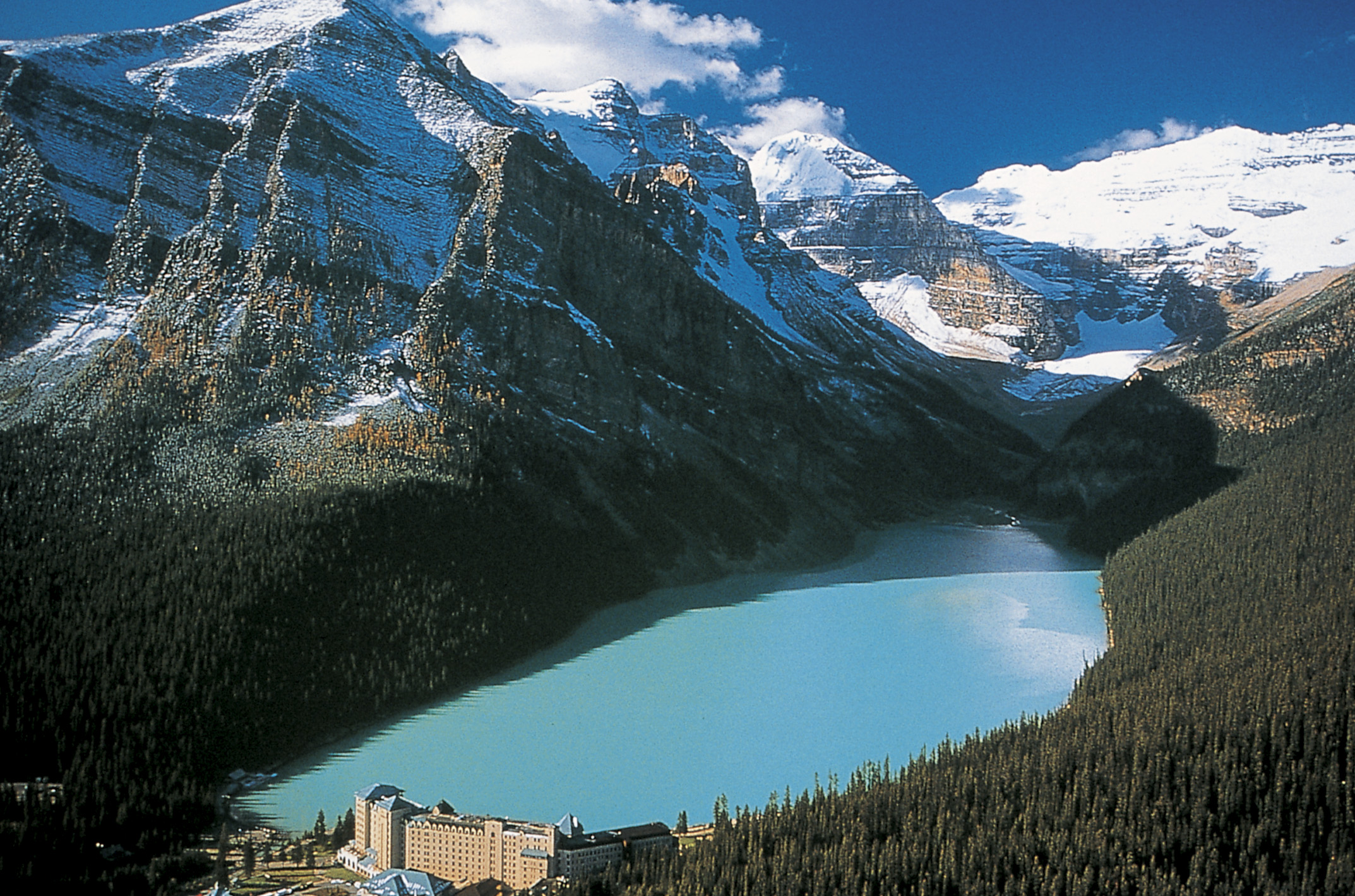
Lake Technical Terms
Lake: An inland body of permanently standing water fresh or saline, occupying a depression on the Earth’s surface, generally of appreciable size (larger than a pond) and too deep to permit vegetation (excluding subaqueous vegetation) to take root completely across the expanse of water. GG
Expose Lagoonal Deposit

Lagoonal Deposit Technical Terms
Lagoonal Deposit: Sand, silt or clay-sized sediments transported and deposited by wind, currents, and storm washover in the relatively low-energy, brackish to saline, shallow waters of a lagoon. Compare – estuarine deposit, fluviomarine deposit, marine deposit. SSS
Remember lagoon channel

lagoon channel Technical Terms
lagoon channel: A subaqueous, sinuous area within a lagoon that likely represents a relict channel (paleochannel) (Wells et al., 1994) that is maintained by strong currents during tidal cycles (Short, 1975). SSS
Explain Lagoon Bottom
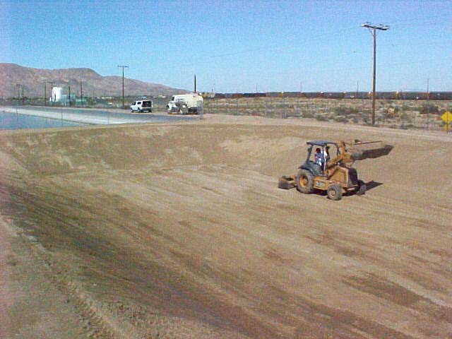
Lagoon Bottom Technical Terms
Lagoon Bottom: The nearly level or slightly undulating central portion of a submerged, low-energy, depositional estuarine basin (McGinn, 1982) characterized by relatively deep water (1.0 to >2.5 m). Compare – bay bottom. SSS
Remember Lagoon
Lagoon Technical Terms
Lagoon: A shallow stretch of salt or brackish water, partly or completely separated from a sea or lake by an offshore reef, barrier island, sandbank or spit. GG‘87. [relict landform] A nearly level, filled trough or depression behind the longshore bar on a barrier beach and built by a receding pluvial or glacial lake. Compare - sewage lagoon. FFP
Expose Kegel Karst
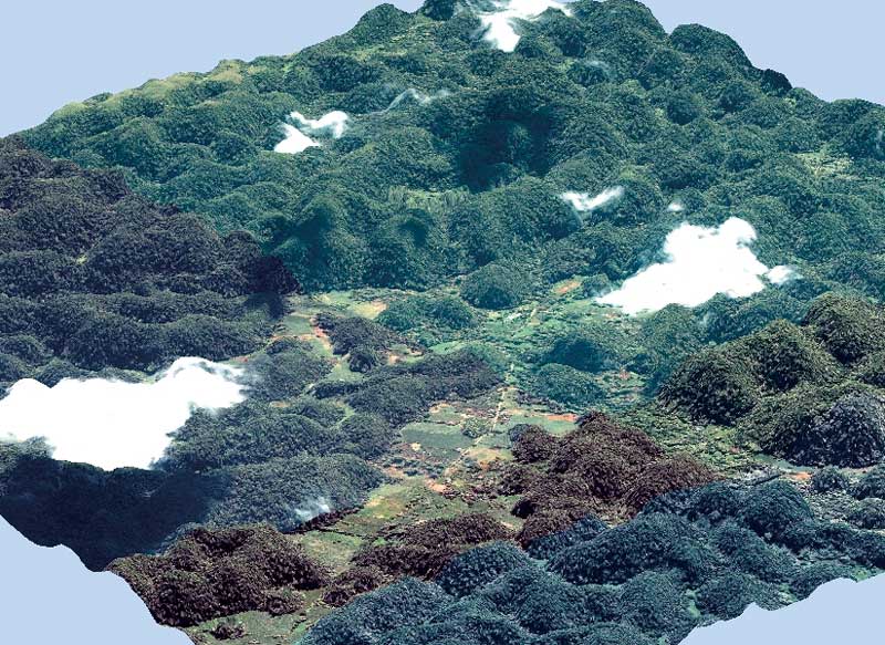
Kegel Karst Technical Terms
Kegel Karst: A general name used to describe several types of humid tropical karst landscapes characterized by numerous, closely spaced cone- (cone karst), hemispherical- (halbkugelkarst), or tower-shaped (tower karst) hills with vertical or near-vertical walls and having intervening closed depressions and narrow steep-walled karst valleys or passageways. Compare – cockpit karst. GG & SW
Expose Kegel Karst

Kegel Karst Technical Terms
Kegel Karst: A general name used to describe several types of humid tropical karst landscapes characterized by numerous, closely spaced cone- (cone karst), hemispherical- (halbkugelkarst), or tower-shaped (tower karst) hills with vertical or near-vertical walls and having intervening closed depressions and narrow steep-walled karst valleys or passageways. Compare – cockpit karst. GG & SW
Expose Karst Valley

Karst Valley Technical Terms
Karst Valley: A closed depression formed by the coalescence of multiple sinkholes; an elongate, solutional valley. Its drainage is subsurface, diameters range from several hundred meters to a few kilometers, and it usually has a scalloped margin inherited from the sinkholes. It may have nominal, local channel flow (small streams), sequential sinkhole inlets (springs) and outlets (swallow hole, etc.); also called compound sinkhole (not preferred), uvala (not preferred). Compare – sinkhole, interior valley. SW & GG
Expose Karst Tower

Karst Tower Technical Terms
Karst Tower: An isolated, separate hill or ridge in a karst region consisting of an erosional remnant of limestone or other sedimentary rocks with vertical or near-vertical, convex side slopes and commonly surrounded by an alluvial plain, lagoon, or deep rugged ravines. Compare – mogote, karst cone. SW

