Remember Strand Plain
Strand Plain Technical Terms
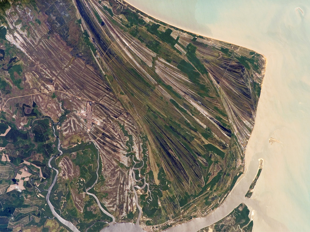
Strand Plain: A prograded shore built seaward by waves and currents, and continuous for some distance along the coast. It is characterized by subparallel beach ridges and swales, in places with associated dunes. GG
Discover Strath Terrace

Strath Terrace Technical Terms
Strath Terrace: A type of stream terrace, formed as an erosional surface cut on bedrock and thinly mantled (e.g. < 3 m) with stream deposits (alluvium), commonly with a gravel lag deposit immediately above the bedrock. SW & GG
Expose Stratified
Stratified Technical Terms
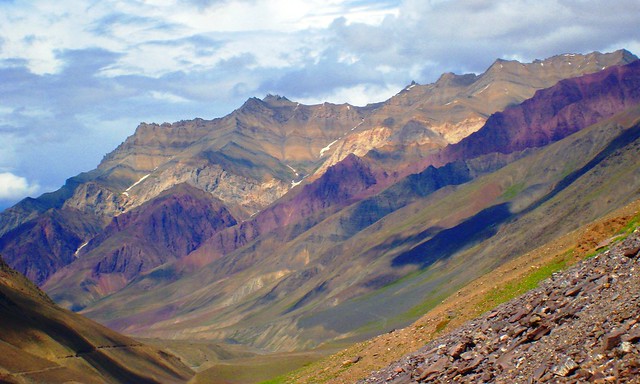
Stratified: Formed, arranged, or laid down in layers. The term refers to geologic deposits. Layers in soils that result from the processes of soil formation are called horizons; those inherited from the parent material are called strata. HP
Explain Stratigraphy

Stratigraphy Technical Terms
Stratigraphy: The branch of geology that deals with the definition and interpretation of layered earth materials; the conditions of their formation; their character, arrangement, sequence, age, and distribution; and especially their correlation by the use of fossils and other means. The term is applied both to the sum of the characteristics listed and a study of these characteristics. HP
Discover Stratovolcano

Stratovolcano Technical Terms
Stratovolcano: A volcano that is constructed of alternating layers of lava and pyroclastic deposits, along with abundant dikes and sills. Viscous, acidic lava may flow from fissures radiating from a central vent, from which pyroclastics are ejected. Compare - shield volcano. GG
Explain Stream
.jpg)
Stream Technical Terms
Stream: Any body of running water that moves under gravity to progressively lower levels, in a relatively narrow but clearly defined channel on the ground surface, in a subterranean cavern, or beneath or in a glacier. It is a mixture of water and dissolved, suspended, or entrained matter. (b) A term used in quantitative geomorphology interchangeably with channel. Compare - river. GG
Expose Stream Order

Stream Order Technical Terms
Stream Order: An integer system applied to tributaries (stream segments) that documents their relative position within a drainage basin network as determined by the pattern of its confluences. The order of the drainage basin is determined by the highest integer. Several systems exist. In the Strahler system, the smallest unbranched tributaries are designated order 1; the confluence of two first-order streams produces a stream segment of order 2; the junction of two second-order streams produces a stream segment of order 3, etc. GG
Expose Stream Terrace

Stream Terrace Technical Terms
Stream Terrace: One, or a series of flat-topped landforms in a stream valley that flank and are parallel to the stream channel, originally formed by a previous stream level, and representing remnants of an abandoned flood plain, stream bed, or valley floor produced during a past state of fluvial erosion or deposition (i.e., currently very rarely or never flooded; inactive cut and fill and/or scour and fill processes). Erosional surfaces cut into bedrock and thinly mantled with stream deposits (alluvium) are called "strath terraces." Remnants of constructional valley floors thickly mantled with alluvium are called alluvial terraces. Compare - alluvial terrace, flood-plain step, strath terrace, terrace. HP & SW
Explain Strike

Strike Technical Terms
Strike: The compass direction or trend taken by a structural surface (e.g. a bed or fault plane) as it intersects the horizontal; used in combination with “dip” to describe the orientation of bedrock strata. SW & GG
Explain Strike Valley
Strike Valley Technical Terms
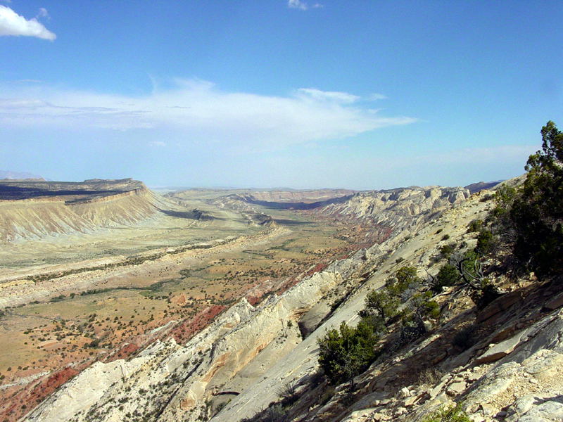
Strike Valley: A subsequent valley eroded in, and developed parallel to the strike of, underlying weak strata, such as a cuesta; a valley that commonly, but not necessarily contains a stream valley. SW & GG
Explain String Bog

String Bog Technical Terms
String Bog: A peatland with roughly parallel, narrow ridges of peat dominated by peat vegetation interspersed with slight depressions, many of which contain shallow pools. The ridges are at right angles to low (< 2o) slopes. They are typically 1 to 3 m wide, up to 1 m high and may be over 1 km long. The ridges are slightly elevated and are better drained allowing shrubs and trees to grow. They are best developed in areas of discontinuous permafrost. NRC
Discover Stripe
Stripe Technical Terms
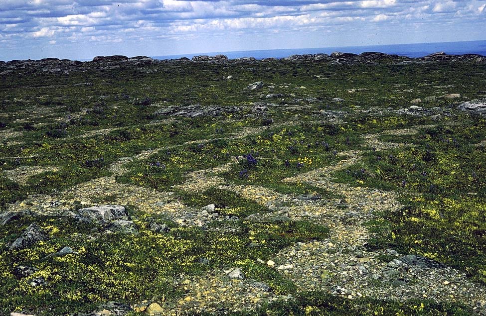
Stripe: A type of patterned ground; one of the alternating bands of fine and coarse surface material, or of rock or soil and vegetation-covered ground, commonly found on steeper slopes. It is usually straight, but may be sinuous or branching. Compare - patterned ground. GG
Explain Stoss

Stoss Technical Terms
Stoss: Said of the side of the hill or knob that faces the direction from which an advancing glacier or ice-sheet moved; facing the upstream (“up-ice”) side of a glacier, and most exposed to its abrasive action. Compare – lee, stoss and lee, crag and tail. GG
Remember Stoss And Lee

Stoss And Lee Technical Terms
Stoss And Lee: An arrangement of small hills or prominent rocks, in a strongly glaciated area, having gentle slopes on the stoss (“up-ice”) side and somewhat steeper, plucked slopes on the lee (“down-ice”) side. This arrangement is the opposite of crag and tail. Compare – crag and tail, drumlin, drumlinoid ridge, flute. GG
Remember Structural Bench

Structural Bench Technical Terms
Structural Bench: A platform-like, nearly level to gently inclined erosional surface developed on resistant strata in areas where valleys are cut in alternating strong and weak layers with an essentially horizontal attitude. Structural benches are bedrock controlled, and in contrast to stream terraces, have no geomorphic implication of former, partial erosion cycles and base-level controls, nor do they represent a stage of flood-plain development following an episode of valley trenching. Compare - pediment, ledge; see scarp. HP
Discover Subaerial

Subaerial Technical Terms
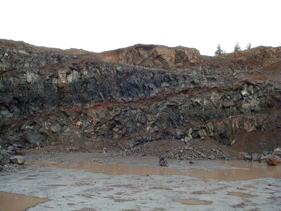
Subaerial: Said of conditions and processes, such as erosion, that exist or operate in the open air on or immediately adjacent to the land surface; or of features and materials, such as eolian deposits, that are formed or situated on the land surface. Compare – subaqueous. GG
Explain Subaerial
Subaerial Technical Terms
Subaerial: Said of conditions and processes, such as erosion, that exist or operate in the open air on or immediately adjacent to the land surface; or of features and materials, such as eolian deposits, that are formed or situated on the land surface. Compare – subaqueous. GG
Discover Subaqueous

Subaqueous Technical Terms
Subaqueous: Said of conditions and processes, features or deposits, that exist or operate in or under water. Compare – subaerial. SSS & GG
Remember Subaqueous Landscapes
Subaqueous Landscapes Technical Terms
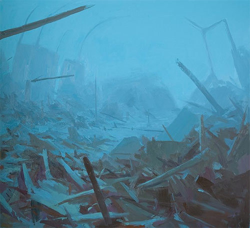
Subaqueous Landscapes: Permanently submerged areas that are fundamentally the same as subaerial (terrestrial) systems in that they have a discernable topography composed of mappable, subaqueous landforms. SSS
Discover Subaqueous Soils

Subaqueous Soils Technical Terms
Subaqueous Soils: Soils that form in sediment found in shallow, permanently flooded environments. Excluded from the definition of these soils are any areas “permanently covered by water too deep (typically greater than 2.5 m) for the growth of rooted plants”. SSS
Discover Subglacial

Subglacial Technical Terms
Subglacial: Formed or accumulated in or by the bottom parts of a glacier or ice sheet; said of meltwater streams, till, moraine, etc. (b) Pertaining to the area immediately beneath a glacier, as subglacial eruption or subglacial drainage. GG
Discover Subglacial Till

Subglacial Till Technical Terms
Subglacial Till: Till deposited in or by the bottom parts of a glacier or ice sheet; types include lodgment till, subglacial flow till; synonym (not preferred; obsolete): basal till. SW & GM
Remember Submerged-Upland Tidal Marsh

Submerged-Upland Tidal Marsh Technical Terms
Submerged-Upland Tidal Marsh: An extensive nearly level, intertidal landform composed of unconsolidated sediments (clays, silts, and/or sand and organic materials), a resistant root mat, vegetated dominantly by hydrophytic (water loving) plants. The mineral sediments largely retain pedogenic horizonation and morphology (e.g. argillic horizons) developed under subaerial conditions prior to submergence due to sea level rise; a type of tidal marsh. Compare – tidal marsh. SW
Remember Submerged Back-Barrier Beach

Submerged Back-Barrier Beach Technical Terms
Submerged Back-Barrier Beach: A permanently submerged extension of the back-barrier beach that generally parallels the boundary between estuary and the barrier island. Compare – submerged mainland beach, barrier beach. SSS
Discover Submerged Mainland Beach
Submerged Mainland Beach Technical Terms
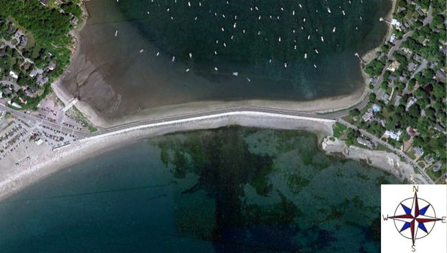
Submerged Mainland Beach: A permanently submerged extension of the mainland beach that generally parallels the boundary between an estuary or lagoon and the mainland. Compare – submerged back-barrier beach, barrier beach. SSS
Explain Submerged Point Bar
Submerged Point Bar Technical Terms
Submerged Point Bar: The submerged extension of an exposed (subaerial) point bar. SSS
Explain Submerged Wave-Built Terrace

Submerged Wave-Built Terrace Technical Terms
Submerged Wave-Built Terrace: A subaqueous, relict depositional landform originally constructed by river or longshore sediment deposits along the outer edge of a wave-cut platform and later submerged by rising sea level or subsiding land surface. Compare wave – built terrace, wave-cut platform. GG
Discover Submerged Wave-Cut Platform

Submerged Wave-Cut Platform Technical Terms
Submerged Wave-Cut Platform: A subaqueous, relict erosional landform that originally formed as a wave-cut bench and abrasion platform from coastal wave erosion and later submerged by rising sea level or subsiding land surface. Compare – wave-built terrace, wave-cut platform. GG
Discover Subtidal

Subtidal Technical Terms
Subtidal: Continuous submergence of substrate in an estuarine or marine ecosystem; these areas are below the mean low tide. Compare – intertidal. SSS & CC
Expose Subtidal Wetlands

Subtidal Wetlands Technical Terms
Subtidal Wetlands: Permanently inundated areas within estuaries dominated by subaqueous soils and submerged aquatic vegetation. SSS
Explain Summit

Summit Technical Terms
Summit: The topographically highest position of a hillslope profile with a nearly level (planar or only slightly convex) surface. Compare - shoulder, backslope, footslope, and toeslope, crest. (b) A general term for the top, or highest area of a landform such as a hill, mountain, or tableland. It usually refers to a high interfluve area of relatively gentle slope that is flanked by steeper slopes, e.g., mountain fronts or tableland escarpments. HP
Remember Supraglacial
Supraglacial Technical Terms
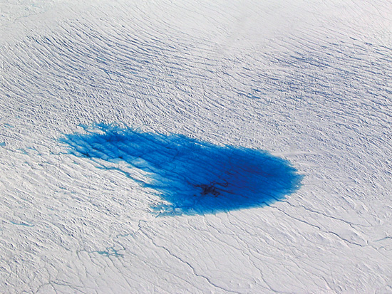
Supraglacial: Carried upon, deposited from, or pertaining to the top surface of a glacier or ice sheet; said of meltwater streams, till, drift, etc. GG
Discover Surface Mine

Surface Mine Technical Terms
Surface Mine: A depression, open to the sky, resulting from the surface extraction of earthy material (e.g. soil / fill) or bedrock material (e.g. coal). Compare – borrow pit, openpit mine, quarry. SW
Explain Relict
Relict Technical Terms
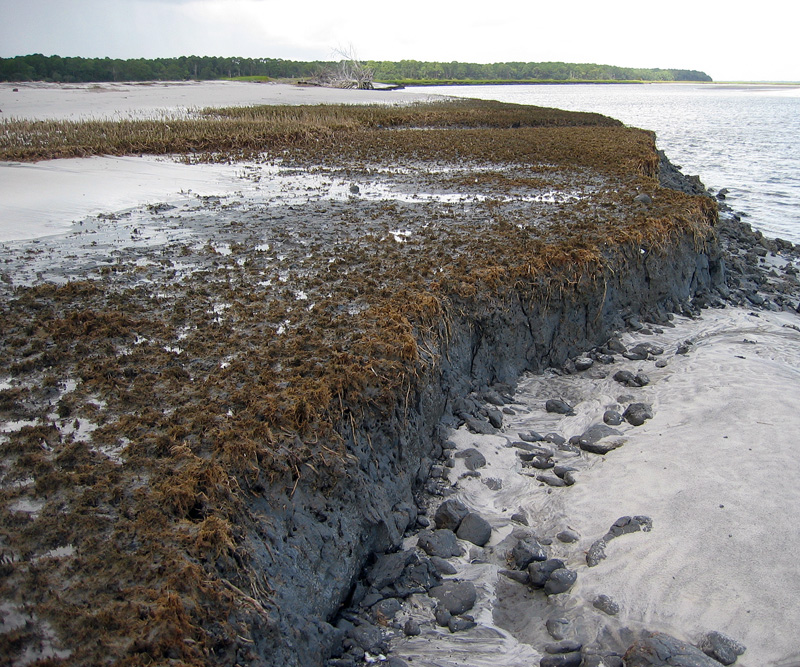
Relict: Pertaining to surface landscape features e.g., landforms, geomorphic surfaces, and paleosols that have never been buried and yet are predominantly products of past environments. Compare - exhumed, buried, ground soil. HP
Expose Swale

Swale Technical Terms
Swale: A shallow, open depression in unconsolidated materials which lacks a defined channel but can funnel overland or subsurface flow into a drainageway. Soils in swales tend to be moister and thicker (cumulic) compared to surrounding soils. SW (b) A small, shallow, typically closed depression in an undulating ground moraine formed by uneven glacial deposition; Compare - swell-and-swale topography. (c) (not preferred; refer to interdune) A long, narrow, generally shallow, trough-like depression between two beach ridges, and aligned roughly parallel to the coastline. GG
Explain Swallow Hole
Swallow Hole Technical Terms
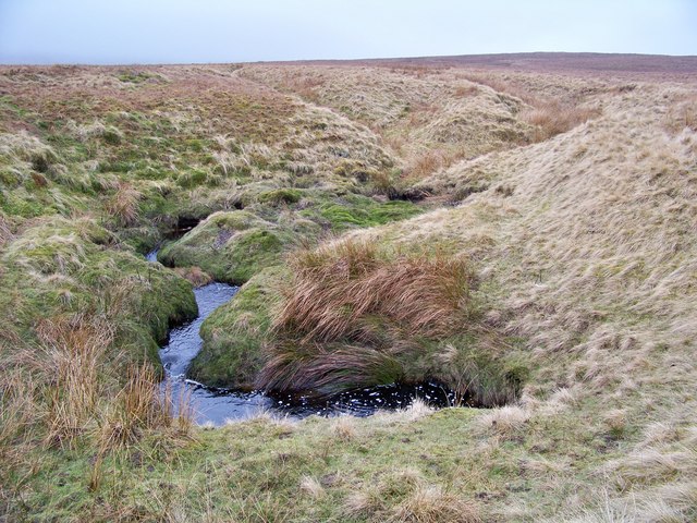
Swallow Hole: A closed depression or doline into which all or part of a stream disappears underground. GG
Discover Swamp

Swamp Technical Terms
Swamp: An area of low, saturated ground, intermittently or permanently covered with water, and predominantly vegetated by shrubs and trees, with or without the accumulation of peat. Compare - marsh, bog, fen. GG
Discover Swash Zone

Swash Zone Technical Terms
Swash Zone: The sloping part of the beach that is alternately covered and uncovered by the uprush of waves, and where longshore movement of water occurs in a zigzag (upslope-downslope) manner. Compare – shoreline. GG
Explain Swell And Swale Topography

Swell And Swale Topography Technical Terms
Swell And Swale Topography: A local scale topography composed of small, well-rounded hillocks and shallow, closed depressions irregularly spaced across low-relief ground moraine (slopes generally 2 – 6%); the effect is a subdued, irregularly undulating surface that is common on ground moraines. Micro-elevational differences generally range from < 1 to < 5 m. SW
Remember Syncline

Syncline Technical Terms
Syncline: A unit of folded strata that is concave upward whose core contains the stratigraphically younger rocks, and occurs at the earth’s surface. In a single syncline, beds forming the opposing limbs of the fold dip toward its axial plane. Compare - monocline, syncline, fold. SW & HP (b) [structural geology] A fold, at any depth, generally concave upward whose core contains the stratigraphically younger rocks. GG
Explain Tableland

Tableland Technical Terms
Tableland: A general term for a broad upland mass with nearly level or undulating summit area of large extent and steep side slopes descending to surrounding lowlands (e.g. a large plateau). Compare - plateau, mesa, cuesta. HP
Remember Talf

Talf Technical Terms
Talf: A geomorphic component of flat plains (e.g., lake plain, low coastal plain, low-gradient till plain) consisting of an essentially flat (e.g. 0-1 % slopes) and broad area dominated by closed depressions and a non-integrated or poorly integrated drainage system. Precipitation tends to pond locally and lateral transport is slow both above and below ground, which favors the accumulation of soil organic matter and a retention of fine earth sediments; better drained soils are commonly adjacent to drainageways. Compare - rise. SW
Explain Talus

Talus Technical Terms
Talus: Rock fragments of any size or shape (usually coarse and angular) derived from and lying at the base of a cliff or very steep rock slope. The accumulated mass of such loose broken rock formed chiefly by falling, rolling, or sliding. Compare - talus slope, colluvium, mass movement, scree. GG
Explain Talus Cone
Talus Cone Technical Terms
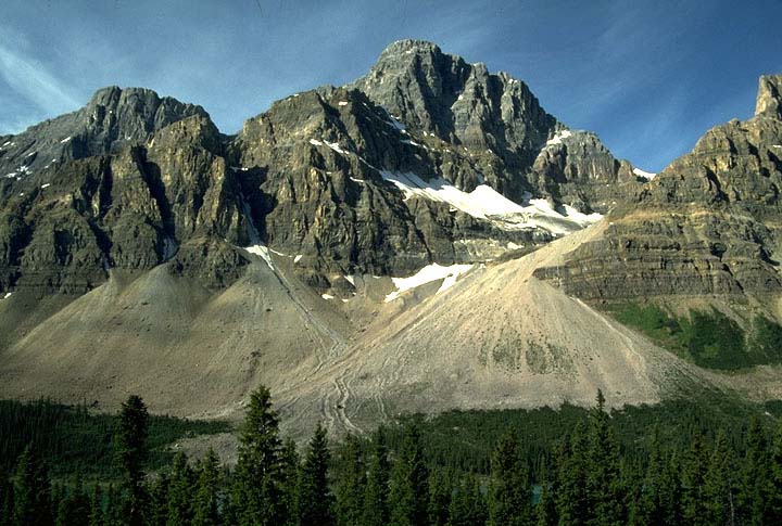
Talus Cone: A steep (e.g. 30 - 40º), cone-shaped landform at the base of a cliff or escarpment that heads in a relatively small declivity or ravine, and composed of poorly sorted rock and soil debris that has accumulated primarily by episodic rockfall or, to a lesser degree, by slope wash. Finest material tends to be concentrated at the apex of the cone. Not to be confused with an alluvial cone; a similar feature but of fluvial origin, composed of better stratified and more sorted material, and that tapers up into a more extensive drainageway. Compare – alluvial cone, beveled base, talus slope. SW
Expose Talus Slope
Talus Slope Technical Terms
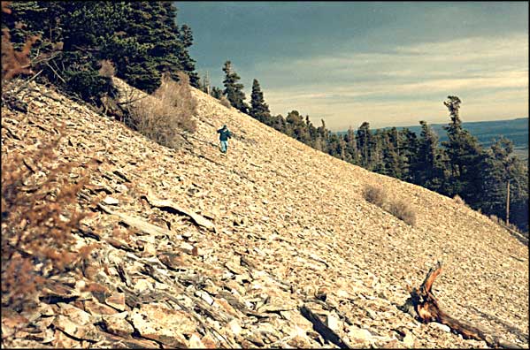
Talus Slope: a portion of a hillslope or mountainslope mantled by talus and lying below a rockfall source (e.g. cliff). Compare – scree slope, scree, talus. Compare – beveled base. SW
Expose Tank
Tank Technical Terms
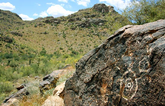
Tank: A natural depression or cavity in impervious rocks in which water collects and remains for the greater part of the year. GG
Discover Tarn

Tarn Technical Terms
Tarn: A relatively deep, steep-banked lake or pool occupying an ice-gouged rock basin amid glaciated mountains. A cirque lake. GG
Remember Tephra

Tephra Technical Terms
Tephra: A collective, general term for any and all clastic materials, regardless of size or composition, ejected from a vent during a volcanic eruption and transported through the air; including ash [volcanic; < 2 mm], blocks [volcanic; > 64 mm], cinders [volcanic; 2 – 64 mm], lapilli [2 - 76 mm & specific gravity > 2.0], pumice [> 2 mm & specific gravity < 1.0], and scoria [> 2 mm & specific gravity < 2.0]. Tephra, unlike many volcaniclastic terms, does not denote properties of composition, vesicularity, or grain size. SW
Explain Terminal Moraine

Terminal Moraine Technical Terms
Terminal Moraine: An end moraine that marks the farthest advance of a glacier and usually has the form of a massive arcuate or concentric ridge, or complex of ridges, underlain by till and other drift types. Compare - end moraine, recessional moraine, ground moraine. HP and GG
Remember Terrace

Terrace Technical Terms
Terrace: A step-like surface, bordering a valley floor or shoreline, that represents the former position of a flood plain, or lake or sea shore. The term is usually applied to both the relatively flat summit surface (tread), cut or built by stream or wave action, and the steeper descending slope (scarp, riser), graded to a lower base level of erosion. Compare - stream terrace, flood-plain step. HP. [ soil survey] Practically, terraces are considered to be generally flat alluvial areas above the 100 yr. flood stage. SW

