Expose Nunatak
Nunatak Technical Terms
Nunatak: An isolated hill, knob, ridge, or peak of bedrock that projects prominently above the surface of a glacier and is completely surrounded by glacier ice. Compare - inselberg, monadnock. GG
Remember Nuée Ardent

Nuée Ardent Technical Terms
Nuée Ardent: A swiftly flowing, turbulent gaseous cloud, sometimes incandescent, erupted from a volcano and containing ash and other pyroclastics in its lower part; a density current of pyroclastic flow. Compare - lahar. GG
Discover Novaculite

Novaculite Technical Terms
Novaculite: A dense, even-textured, extremely finely grained, siliceous, sedimentary rock recrystallized from chert with microcrystalline quartz dominant over chalcedony (cryptocrystalline quartz). It is hard, white to grayish-black in color, translucent on thin edges, has a dull to waxy luster, and displays smooth conchoidal fracture when broken. Novaculite occurs in the Ouachita Mountains of AR and OK and the Marathon Uplift of TX where it forms erosion resistant ridges. At the Ouachita Mountain type occurrence, novaculite formed by low-grade, thermal metamorphism of bedded chert. This rock serves widely as a whetstone or oilstone. Compare - chert. SW & GG
Expose Notch

Notch Technical Terms
Notch: A narrow passageway, or short defile between mountains; a deep, close pass. Compare - gap. (b) A breached opening in the rim of a volcanic crater. GG
Remember Nose Slope

Nose Slope Technical Terms
Nose Slope: A geomorphic component of hills consisting of the projecting end (laterally convex area) of a hillside, resulting in predominantly divergent overland water flow (e.g., sheet wash); contour lines generally form convex curves. Nose slopes are dominated by colluvium and slope wash sediments (e.g., slope alluvium). Slope complexity (downslope shape) can range from simple to complex. Nose slopes are comparatively drier portions of hillslopes and tend to have thinner colluvial sediments and profiles. Compare - head slope, side slope, free face, interfluve, crest, base slope. SW
Remember Nonsorted Circle
Nonsorted Circle Technical Terms
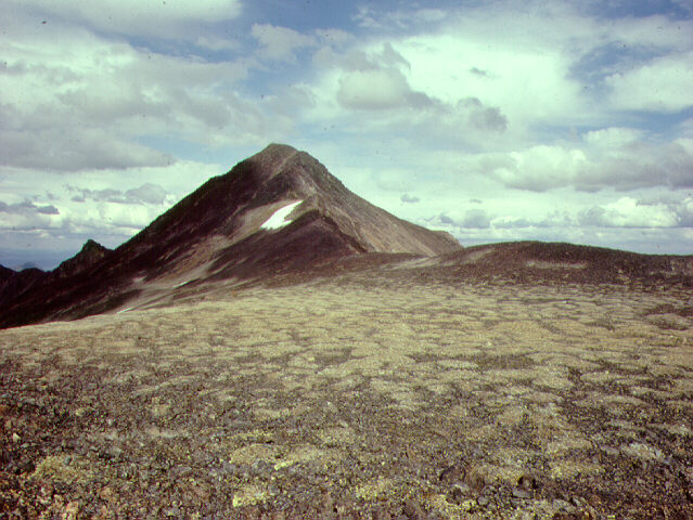
Nonsorted Circle: A type of patterned ground whose mesh (shape) is dominantly circular and has a nonsorted appearance due to the absence of a boarder of coarse fragments. Vegetation characteristically outlines the pattern by forming a bordering ridge. Diameters commonly range from 0.5 to 3 m. Nonsorted circles include mud boils, earth hummocks, turf hummocks, and frost boils. Nonsorted circles have various origins. Some, such as mud and earth hummocks and frost boils, involve cryoturbation activity and differential heave of frost-susceptible materials. Others, such as mud boils, involve hydraulic pressures and diapir-like displacement of water-saturated sediments. Compare - sorted circle, frost boil, patterned ground. NRC and GG
Remember Nivation Hollow
Nivation Hollow Technical Terms
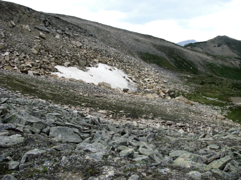
Nivation Hollow: A shallow, non-cliffed depression or hollow on a mountain side permanently or intermittently occupied by a snow bank or snow patch and produced by nivation. If the snow completely melts each summer the hollow is deepened; otherwise not; may be a cirque precursor if further enlarged and deepened by alpine glaciation. GG
Explain Nivation

Nivation Technical Terms
Nivation: The process of excavation of a shallow depression or nivation hollow on a mountain side by removal of fine material around the edge of a shrinking snow patch or snow bank, chiefly through sheetwash, rivulet flow, and solution in melt water. Freeze-thaw action is apparently insignificant. GG
Remember Neck

Neck Technical Terms
Neck: A vertical, pipe-like tower of solidified lava or consolidated fragmental igneous rock that represents a former volcanic vent whose surrounding material (e.g. tuff and tephra) has been largely removed by erosion. Compare – plug [volcanic], diatreme. SW, GG, & GS
Remember Natural Levee

Natural Levee Technical Terms
Natural Levee: A long, broad low ridge or embankment of sand and coarse silt, built by a stream on its flood plain and along both sides of its channel, especially in time of flood when water overflowing the normal banks is forced to deposit the coarsest part of its load. It has a gentle slope away from the river and toward the surrounding floodplain, and its highest elevation is closest to the river bank. Compare - levee, artificial levee, meander belt. GG
Remember Muskeg

Muskeg Technical Terms
Muskeg: A bog, usually a sphagnum bog, frequently with grassy tussocks (hummocks), growing in wet, poorly drained boreal regions, with deep accumulations of organic material, often in areas of permafrost; a moss-covered muck or peat bog of boreal regions. GG and HP
Discover Mudstone
Mudstone Technical Terms
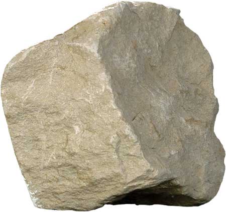
Mudstone: A blocky or massive, fine-grained sedimentary rock in which the proportions of clay and silt are approximately equal; (b) A general term that includes clay, silt, claystone, siltstone, shale, and argillite, and that should be used only when the amounts of clay and silt are not known or cannot be precisely identified. GG
Explain Mudflow

Mudflow Technical Terms
Mudflow: The process, associated sediments (mudflow deposit) or resultant landform characterized by a very rapid type of earthflow dominated by a sudden, downslope movement of a saturated mass of rock, soil, and mud (more than 50 % of the particles are < 2 mm), that behaves as much as a viscous fluid when moving. Compare – debris flow, flow, landslide. SW & DV
Expose Mud Flat

Mud Flat Technical Terms
Mud Flat: A relatively level area of fine grained material (e.g. silt) along a shore (as in a sheltered estuary) or around an island, alternately covered and uncovered by the tide or covered by shallow water, and barren of vegetation. Compare – low marsh, tidal flat, tidal marsh. GG
Explain Mucky Peat
Mucky Peat Technical Terms
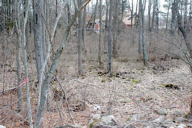
Mucky Peat: Unconsolidated soil material consisting primarily of organic matter that is in an intermediate stage of decomposition such that a significant part of the original material can be recognized and a significant part of the material can not be recognized (i.e. "hemic" in Soil Taxonomy). Compare - peat, muck, herbaceous peat. SSM
Expose Mountain Valley

Mountain Valley Technical Terms
Mountain Valley: Any small, externally drained V-shaped depression (in cross-section) cut or deepened by a stream and floored with alluvium, or a broader, U-shaped depression modified by an alpine glacier and floored with either till or alluvium, that occurs on a mountain or within mountains. Several types of mountain valleys can be recognized based on their form and valley floor sediments (i.e., V-shaped valley, U-shaped valley). Compare – valley. SW (b) (colloquial: Basin and Range, USA) A relatively small, structural depression within a mountain range that is partly filled with alluvium and commonly drains externally to an intermontane basin, bolson, or semi-bolson. Compare - valley flat. SW & FFP
Expose Mountaintop
Mountaintop Technical Terms
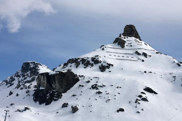
Mountaintop: A geomorphic component of mountains consisting of the uppermost, comparatively level or gently sloped area of mountains, characterized by relatively short, simple slopes composed of bare rock, residuum, or short-transport colluvial sediments. In humid environments, mountaintop soils can be quite thick and well developed. Compare - mountainflank, mountainbase, free face, geomorphic component. SW
Discover Mountain System

Mountain System Technical Terms
Mountain System: A group of mountain ranges exhibiting certain unifying features, such as similarity in form, structure and alignment, and presumably originating from the same general causes; especially a series of mountain ranges belonging to an orogenic belt. Compare – mountain range, mountains. GG
Expose Mountain Slope
Mountain Slope Technical Terms
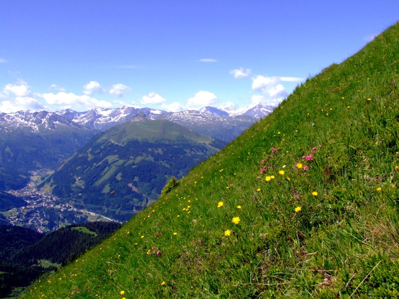
Mountain Slope: A part of a mountain between the summit and the foot. Compare – mountainflank, hillslope. GG
Remember Mountains

Mountains Technical Terms
Mountains: A region or landscape characterized by mountains and their intervening valleys; a generic name for any group, cluster, or sequence of mountains or narrowly spaced mountain ridges, with or without peaks, closely related in position, orientation, direction, formation, or age, and whose summits commonly exceed 300 m (approx. 1000 ft). Compare – foothills, hills, mountain range, mountain system. SW.
Explain Mountain Range
Mountain Range Technical Terms
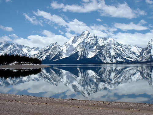
Mountain Range: A single, large mass consisting of a succession of mountains or narrowly spaced mountain ridges, with or without peaks, closely related in position, direction, orientation, formation, and age; a component part of a mountain system. Compare – mountain system, mountains. GG
Discover Mountainflank

Mountainflank Technical Terms
Mountainflank: A geomorphic component of mountains consisting of the side area of mountains, characterized by very long, complex backslopes with comparatively high slope gradients and composed of highly-diverse, colluvial sediment mantles, complex near-surface hydrology, mass movement processes and features (e.g., creep, landslides); rock outcrops or structural benches may be present. The mountainflank can be subdivided by the general location along the mountainside (i.e., upper third, middle third, or lower third mountainflank). Compare - mountaintop, mountainbase, free face, geomorphic component. SW
Discover Mountainbase

Mountainbase Technical Terms
Mountainbase: A geomorphic component of mountains consisting of the lowermost area, consisting of the strongly to slightly concave colluvial apron or wedge at the bottom of mountain slopes; composed of long-transport colluvium and slope alluvium sediment. It can extend out onto more level valley areas where it ultimately interfingers with, is buried by alluvium or is replaced by re-emergent residuum. Compare - mountaintop, mountainflank, free face, geomorphic component. SW
Discover Mountain

Mountain Technical Terms
Mountain: A generic term for an elevated area of the land surface, rising more than 300 meters above surrounding lowlands, usually with a nominal summit area relative to bounding slopes and generally with steep sides (greater than 25 percent slope) with or without considerable bare-rock exposed. A mountain can occur as a single, isolated mass or in a group forming a chain or range. Mountains are primarily formed by tectonic activity and/or volcanic action and secondarily by differential erosion. Compare - hill, hillock, plateau, foothills, mountains. SW & HP
Remember mound

mound Technical Terms
mound: A low, rounded natural hill of unspecified origin, generally < 3 m high and, composed of earthy material; (b) A small, human-made hill, composed either of debris accumulated during successive occupations of the site (e.g. tell) or of earth heaped up to mark a burial site (e.g. burial mound). (c) A structure built by colonial organisms (e.g. termite mound). GG
Remember Moss Peat

Moss Peat Technical Terms
Moss Peat: An accumulation of organic material that is predominantly the remains of mosses (e.g. sphagnum moss). Compare - Herbaceous peat, sedimentary peat, woody peat, peat, muck, and mucky peat. SSM
Discover Moraine

Moraine Technical Terms
Moraine: (a) [material] A mound, ridge, or other topographically distinct accumulation of unsorted, unstratified glacial drift, predominantly till, deposited primarily by the direct action of glacier ice, in a variety of landforms. (b) [landform] A general term for a landform composed mainly of till that has been deposited by a glacier; a kame moraine is a type of moraine similar in exterior form to other types of moraines but composed mainly of stratified outwash materials. Types of moraine include: disintegration, end, ground, kame, lateral, recessional, and terminal. SW
Explain Monocline

Monocline Technical Terms
Monocline: A unit of folded strata that dips from the horizontal in one direction only, is not part of an anticline or syncline, and occurs at the earth’s surface. This structure is typically present in plateau areas where nearly flat strata locally assume steep dips caused by differential vertical movements without faulting. Compare - anticline, syncline, fold. SW & HP (b) [structural geology]- A local steepening in an otherwise uniform gentle dip. GG
Remember Monadnock

Monadnock Technical Terms
Monadnock: An isolated hill or mountain of resistant rock rising conspicuously above the general level of a lower erosion surface in a temperate climate representing an isolated remnant of a former erosion cycle in an area that has largely been beveled to its base level. Compare - inselberg, nunatak. GG
Remember Mogote

Mogote Technical Terms
Mogote: An isolated, steep-sided, commonly asymmetrical hill or ridge composed of limestone, generally steeper on its leeward side (prevailing downwind side) and surrounded by nearly level to sloping coastal plain composed of marine and alluvial sediments; a type of karst tower. They range in height from a few feet (< 1 m) to over 150 ft (50 m). Most are isolated and cover small areas but some form clusters of hills or ridges rising out of the surrounding blanket deposits. Mogotes are extensive in northern Puerto Rico. SW, Monroe (1976, 1980), & WW.
Explain Miocene

Miocene Technical Terms
Miocene: An epoch of the Tertiary Period of geologic time (approximately 5.2 to 23 million years ago) that immediately follows the Oligocene and precedes the Pliocene Epoch; also the corresponding (time-stratigraphic) "series" of earth materials. HP
Remember Minor Scarp

Minor Scarp Technical Terms
Minor Scarp : A steep surface on the displaced material of a landslide, produced by differential movements within the sliding mass. Compare – main scarp, toe. CV
Explain Mine Spoil Or Earthy Fill
Mine Spoil Or Earthy Fill Technical Terms
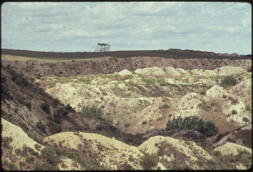
Mine Spoil Or Earthy Fill: An accumulation of displaced earthy material, rock, or other waste material removed during mining or excavation. SW & GSST
Discover Mine Spoil, Metal-Ore Extraction

Mine Spoil, Metal-Ore Extraction Technical Terms
Mine Spoil, Metal-Ore Extraction: Randomly mixed, earthy materials artificially deposited as a result of either surficial or underground metal-ore mining activities; a type of mine spoil. SW
Remember Mine Spoil, Coal Extraction

Mine Spoil, Coal Extraction Technical Terms
Mine Spoil, Coal Extraction: Randomly mixed, earthy materials artificially deposited as a result of either surficial or underground coal mining activities; a type of mine spoil. SW
Remember Mima Mound

Mima Mound Technical Terms
Mima Mound: A term used for one of numerous low circular or oval domes composed of loose, unstratified, gravelly, silty, or sandy material. The basal diameter varies from 3 meters to more than 30 meters, and the height from 30 centimeters to about 2 meters. Compare - pimple mound, patterned ground, shrub-coppice dune. GG
Explain Midden

Midden Technical Terms
Midden: A mound or stratum of refuse (broken pots, ashes, food remains, etc.) normally found on the site of an ancient settlement. GG
Explain Microrelief

Microrelief Technical Terms
Microrelief: (a) [soil survey] Slight variations in the height of a land surface that are too small or intricate to delineate on a topographic or soils map at commonly used map scales (e.g. 1:24,000 through 1:10,000). Examples include microhigh, microlow. Compare - microfeature. SW (b) (not preferred - refer to microfeature) Generically refers to local, slight irregularities in form and height of a land surface that are superimposed upon a larger landform, including such features as low mounds, swales, and shallow pits. GG
Discover Microlow

Microlow Technical Terms
Microlow: A generic microrelief term applied to slightly lower areas relative to the adjacent ground surface (e.g. shallow depression); changes in relief range from several centimeters to several meters; cross-sectional profiles can be simple or complex and generally consist of subdued, concave, open or closed depressions with gently sloping sides; also spelled micro-low. SW.
Remember Microbiotic Crust
Microbiotic Crust Technical Terms
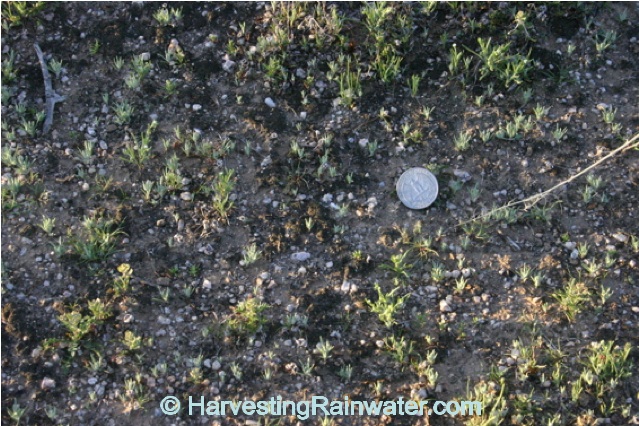
Microbiotic Crust: A thin, surface layer (crust) of soil particles bound together primarily by living organisms and their organic byproducts; thickness can range up from < 1 cm up to 10 cm; aerial coverage of the ground surface can range from 10 - 100%. Crusts stabilize loose earthy material. Other types of surface crusts include chemical crusts (e.g., salt crusts) and physical crusts (e.g., raindrop-impact crust). SW & SS
Expose Meteorite Crater

Meteorite Crater Technical Terms
Meteorite Crater: An impact crater formed by the falling of a large meteorite onto the earth’s surface; e.g., Barringer Crater (AZ). Compare – crater, impact crater. SW & GG
Remember Metasediment
Metasediment Technical Terms
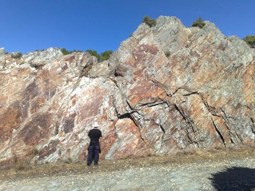
Metasediment: A sediment or sedimentary rock that shows evidence of having been subjected to metamorphism. GG
Remember Metamorphic Rock

Metamorphic Rock Technical Terms
Metamorphic Rock: Rock of any origin altered in mineralogical composition, chemical composition, or structure by heat, pressure, and movement at depth in the earth's crust. Nearly all such rocks are crystalline. Examples: schist, gneiss, quartzite, slate, marble. HP
Explain Mesa

Mesa Technical Terms
Mesa: A broad, nearly flat-topped, and usually isolated landmass bounded by steep slopes or precipitous cliff and capped by layers of resistant, nearly horizontal, rocky summit width greater than the height of bounding escarpments. (Colloquial: western USA; not preferred) Also used to designate broad structural benches and alluvial terraces that occupy intermediate levels in stepped sequences of platforms bordering canyons and valleys. Compare - butte, plateau, cuesta. HP & GG
Expose Melt-Out Till

Melt-Out Till Technical Terms
Melt-Out Till: Till derived from slow melting of debris-rich stagnant ice buried beneath sufficient overburden to inhibit deformation under gravity, thus preserving structures derived from the parent ice. Compare - flow-till, lodgment till. GG
Discover Medial Moraine
Medial Moraine Technical Terms
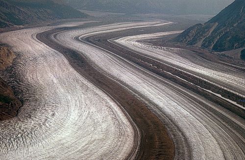
Medial Moraine: (a) An elongate moraine carried in or upon the middle of a glacier and parallel to its sides, usually formed by the merging of adjacent and inner lateral moraines below the junction of two coalescing valley glaciers. (b) A moraine formed by glacial abrasion of a rocky protuberance near the middle of a glacier and whose debris appears at the glacier surface in the ablation area. (c) The irregular ridge left behind in the middle of a glacial valley, when the glacier on which it was formed has disappeared. GG
Discover Meander Scroll
Meander Scroll Technical Terms
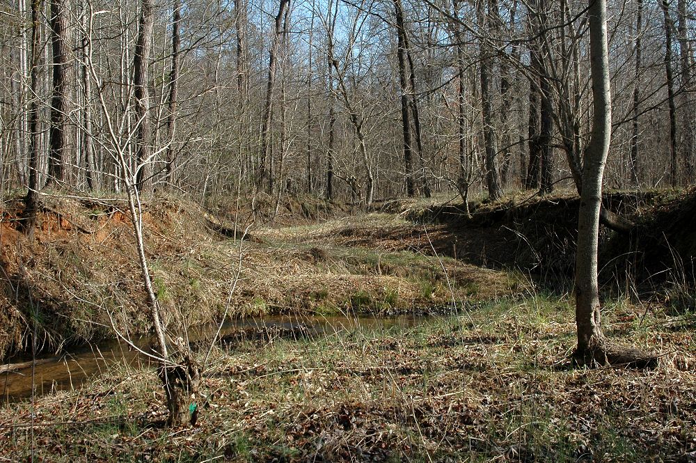
Meander Scroll: (a) One of a series of long, parallel, close fitting, crescent-shaped ridges and troughs formed along the inner bank of a stream meander as the channel migrated laterally down-valley and toward the outer bank. Compare - meander belt, point bar. (b) (not recommended; refer to oxbow lake) - A small, elongate lake on a flood plain in a well-defined part of an abandoned stream channel. GG
Discover Meander Scar

Meander Scar Technical Terms
Meander Scar: (a) A crescent-shaped, concave or linear mark on the face of a bluff or valley wall, produced by the lateral erosion of a meandering stream which impinged upon and undercut the bluff; if it’s no longer adjacent to the modern stream channel it indicates an abandoned route of the stream. SW; (b) (not recommended – refer to oxbow) An abandoned meander, commonly filled in by deposition and vegetation, but still discernable. GG
Explain Meandering Channel
Meandering Channel Technical Terms
Meandering Channel: The term "meandering" should be restricted to loops with channel length more than 1.5 to 2 times the meander wave length. Meandering stream channels commonly have cross sections with low width-to-depth ratios, cohesive (fine-grained) bank materials, and low gradient. At a given bank-full discharge, meandering streams have gentler slopes, and deeper narrower, and more stable channel cross sections than braided streams. Compare - meander, braided stream, flood-plain landforms. HP & RR
Discover Meander Belt

Meander Belt Technical Terms
Meander Belt: The zone within which migration of a meandering channel occurs; the flood-plain area included between two imaginary lines drawn tangential to the outer bends of active channel loops. Landform components of the meander-belt surface are produced by a combination of gradual (lateral and down-valley) migration of meander loops and avulsive channel shifts causing abrupt cut-offs of loop segments. Landforms flanking the sinuous stream channel include: point bars, abandoned meanders, meander scrolls, oxbow lakes, natural levees, and flood-plain splays. Meander belts may not exhibit prominent natural levee or splay forms. Flood plains of broad valleys may contain one or more abandoned meander belts in addition to the zone flanking the active stream channel. HP

